Resilient Urban Centres and Surrounds (RUCaS)
Makkasan Zone C Departure Park
Bangkok, Thailand
Makassan wetlands with flood detention, and expressways
The vision for this case study is creating an urban sanctuary that seamlessly integrates with the modern cityscape while managing canal flows and water quality in heavily built up areas.
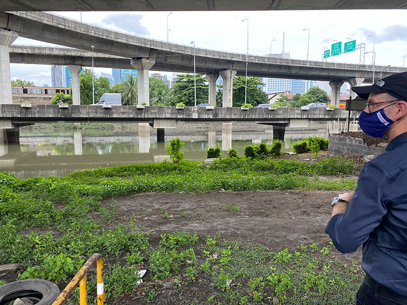
Makkasan is in the heart of Bangkok and surrounded by major shopping, residential high rise and commercial sites. The 497 rai land parcel was gifted to the railway authority (now the State Railway of Thailand – SRT) to be a transport hub. Until the early 1980s, Makkasan was the biggest hub of train production in Southeast Asia, and still has repair yards and workshops. However, much of the railyards has been left undeveloped, and includes open space, tracks and warehouses for construction, maintenance and storage for trains and rolling stock. This has created a uniquely green space in the centre of Bangkok with large areas that are fallow, and include lakes and wetlands that detain and retain waters before they recede (or are pumped) to the canals and river.
Makkasan now faces increasing pressure from urban development, such as plans to develop a highspeed rail (HSR) project linking 3 gateway airports – Suvarnabhumi in Samut Prakan, Don Mueang in Bangkok and U-Tapao in Rayong. SRT is also exploring options to lease some land for development. Civic groups are calling to retain space for urban heritage conservation and the environment to preserve these values for future generations.
Following proposals from residents, the union and local groups, SRT is considering how the Zone C area of the Makkasan marsh and railyards can be preserved and further developed as a green area linking and extending water management and public green spaces and parks in Bangkok. The area is prone to flooding from surrounding canals, the Chao Phraya River and pluvial stormwater sources (roads, hard surfaces) in and around the site. As the area is surrounded by important transport corridors (rail, road, fast train, canals), urban heat is an issue. Water quality is also an issue, with grey and black water entering both canals and ponds.
The RUCaS team is collaborating with the Bangkok Metropolitan Administration (BMA), SRT, Kasersart University, Urban Action, the Community Organizations Development Institute and the SRT Union to assess options to create a dynamic, accessible area within Area C where people, nature, water and transit converge.
The case study proposes a wider vision for Area C encompassing nature-based solutions (NbS), nature play and nature art across 2 zones:
- Eastern zone is designed as a wetland park with surface and subsurface wetlands, lakes and forest.
- Western zone is designed as a forest park with sport facilities and forested areas.
Throughout the site, NbS will be integrated into the landscape – overlaying water and nature play for children and creating a multifunctional, accessible and multidimensional oasis. The design also aims to mitigate noise pollution from the adjoining road, create a cooling environment and enhance evapotranspiration.
A more detailed concept was developed for the Eastern Zone wetland park focusing on:
- increased flood detention capacity through floodable open space/parks
- water quality treatment that improves the wider canal system
- improved public amenity by providing access to green and blue space in the centre of Bangkok
- urban heat mitigation by providing cooling shelter against extreme heat waves
- diversified urban ecology and amenity.
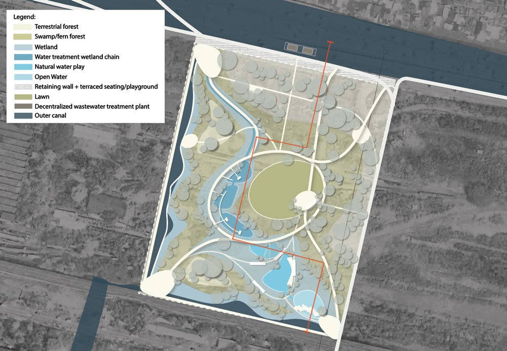
Indicative Plan (not to scale and illustrative only
What does a Water Sensitive City look like?
The CRCWSC has produced research, guidelines and
tools related to the following topics:
Integrated Urban Flood
Management
Climate change
mitigation
Community
engagement
Economics and
business case