September 5, 2024
/
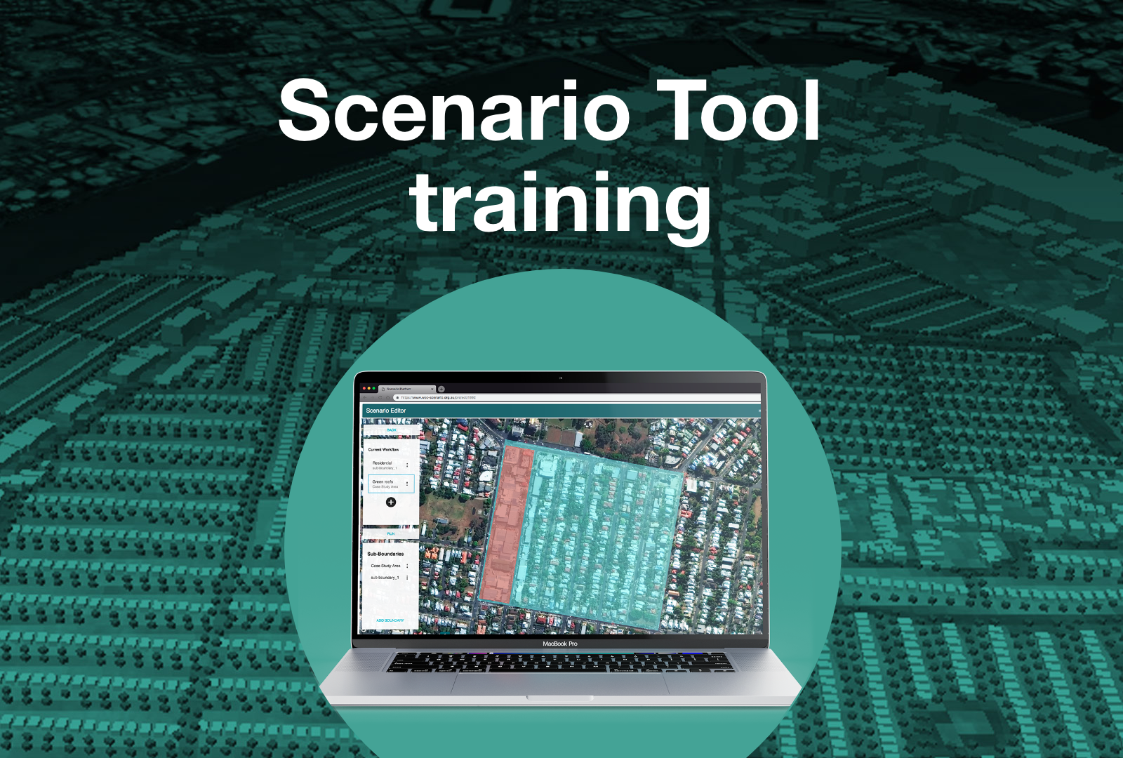
Modelling the impacts of water sensitive investments using the Scenario Tool
The Scenario Tool is a planning-support tool that simulates how water sensitive investments can affect land surface and air temperatures and water flows into and out of an area.
When: We are running training, Wednesday 16 October 2024, 12–3 pm AEDT.
The training is useful for consultants, planners, water practitioners, researchers or anyone else interested in understanding interactions between water and urban planning.
Where: Via Zoom.
REGISTER FOR SCENARIO TOOL TRAINING
Program overview
The Scenario Tool is a powerful online geospatial modelling tool that:
- simulates real life scenarios at the street, precinct or city scale
- outputs heat mapping
- models street level air temperature at fine spatial scales
- quantifies the flow of water in and out of an area.
Pre-training set up: Before the training (beginning Monday 7 October), we will contact registrants to set up and test access to the tool.
Cost: Early bird: $200 for registrations by Thursday 3 October
Full price: $250 for registrations from Friday 4 October
Registrations close Friday 11 October 2024.
About the trainers

Dr Mojtaba Moravej
Mojtaba is a research fellow at the University of Queensland, with broad experience in both academia and industry. His research focuses on the development of integrated models for urban water systems. He has been involved in testing and using the Scenario Tool since its early development stages and leads training workshops, providing participants with practical knowledge and hands-on experience in using the tool.

Dr Christian Urich
Christian is Senior Water Modelling and Data Engineer at HARC. He has extensive experience in developing novel decision support systems that integrate data, climate change, urban development, urban heat, flood and water cycle models to support urban water planning. Before joining HARC, he was the Project Leader for the Tools and Products program for the Cooperative Research Centre for Water Sensitive Cities, leading the development of the Scenario Tool.

Professor Steven Kenway
Steven is Professor at the Australian Centre for Water and Environmental Biotechnology at the University of Queensland. He is a water leader with senior experience in research, industry and government, developed through roles with the University of Queensland, CSIRO, Brisbane Water, Sydney Water and private consulting. He has worked with urban water, wastewater, stormwater, and related energy and greenhouse gas issues since 1990.
REGISTER FOR SCENARIO TOOL TRAINING
More about the Scenario Tool
The tool comprises 4 integrated modules to assess the benefits of water sensitive developments:
- Urban Development Module – Use this module to define urban development scenarios, simulating urban development and infrastructure adaptation. These aspects can be combined to simulate cities as complex and dynamic systems, scaled from street to urban catchment size.
- Simple Land Surface Temperature Module – Use this module to define urban development scenarios, simulating urban development and infrastructure adaptation. These aspects can be combined to simulate cities as complex and dynamic systems, scaled from street to urban catchment size.
- TARGET (The Air-temperature Response to Green/Blue infrastructure Evaluation Tool) Module – Use this module to assess air temperature and human thermal comfort of a given site. For example, what happens to urban heat if hard surfaces are converted to natural ones, or if unirrigated surfaces are converted to irrigated ones?
- Urban Water Cycle Module – Use this module to assess the flow of urban water streams for an area based on user-defined water management strategies. For example, how will changes to the urban form and water cycle infrastructure affect water demand and runoff at the lot, precinct and catchment scale?
Accessed online via a web browser, the tool provides baseline data about land cover and buildings, and Australian meteorological conditions. Or, you can upload customised data sets. The easy-to-use interface showcases 3D models and the underlying data layers. And a dashboard of modelled outcomes from CRCWSC research can inform decision making across different development scenarios.
GO TO THE SCENARIO TOOL PAGE